Today you will get to one of the highest mountains in this way, the Cruz de Ferro cross located in the Monte Irago mount, from this point you will have to descend to get to Ponferrada. Now you will leave the monotonous Castilian landscape to be accompanied by the Montes del Bierzo mounts and also its vegetation, this landscape will be the best companion in one of the hardest stages in this stage.

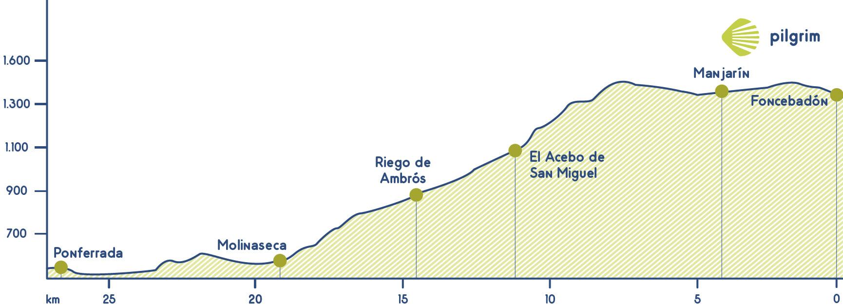
You will leave Foncebadón through the Calle Real street, while leaving this village you will see an old sanctuary and you will be more and more inside the mountain pass. After walking through a path you will get to a crossing with the Le-142, you will cross to a path that will lead you to the Cruz de Ferro cross, the highest point in the French Way (1,504 meters high – XX feet high) just after Somport mountain pass.
Lots of pilgrims throw a rock brought from the starting point. You should through it backward to symbolize that you have concluded these complicated mountains pass. There are lots of theories about its origin, one of them says that it could be chosen to sign the way when it snows in this area, other people believe that this used to be a place where pilgrims pile up pebble because this was a key point. Now you will start to descend through a way parallel to the LE-142 up to get to an asphalted road at the entrance of Manjarín, a little village that was left many years ago but that has an unusual hostel.
In the hottest months there is a mobile bar located after the military base. Then you will get close to El Acebo, a typical village in the Way. It has a main street where the most part of the houses is located. According to the legend this village stop paying taxes in the 15 century in return to sign this are with 800 wood posts to avoid that pilgrims get lost when it snows. Here you can find some hostels and a hotel and also an establishment where you can buy some snacks. You will leave this village through an asphalted road and descending up to a sharp bend where you can see a signposting that indicates you to take to the left. Here we recommend cyclist to continue on the road to Riego de Ambrós, you will go through all the village after going through the Plaza de San Sebastián square.
You will walk among chestnut trees and also hearing the relaxing noise of the Arroyo de Prado stream to get again to the LE-142 for a small period of time. After walking next to a tavern you will see a path to the right. An arrow in a high-tension wire will indicate you that a little bit after you will take the stony left path to descend. This path could be a little bit complicated in some seasons of the year, especially for cyclists.
Ponferrada is now very close. After descending through some paths and seeing a cross, you will get again to an asphalted road that will lead you to Molinaseca, a village deeply linked with St. James. Here is located the Puente de los Peregrinos bridge a medieval jewel that goes over the Miruelo or Meruelo river, you will also see the Santuario de las Angustias Sanctuary. You will cross the Calle Real street to get to Avenida de Fraga Iribarne avenue, and after a tennis court, you will go through a path that goes next to the LE-142 to get to Campo.
This village is from the Middle ages and it has typical houses and also a church devoted to Nuestra Señora de la Encina. Then you will continue next to the Boeza River, you will cross it a little bit after to get to Ponferrada.
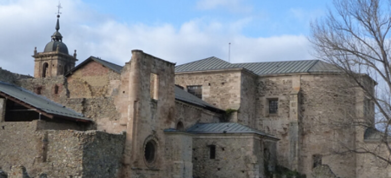
You will get to Ponferrada going through one of the prettiest neighbourhoods You will see a castle located on a hill next to the Boeza and Sil Rivers You can visit many monuments such as the Basílica de la Encina basilica, the council house and also the Torre del Reloj tower.
What to see
Remember.
You will walk among magical towns, villages with centuries of history and unforgettable places. We walk by your side! If you have any doubts about this stage or about other stages, please contact us, we will help you. Have a nice Way, Pilgrim!
What to eat
- Typical fruits from El Bierzo
- Typical peeper from El Bierzo
- Botillo from El Bierzo
- Typical cherries and morello cherry
- Typical wines
- Typical honey
Bear in mind
Cyclists will find many dangerous points, such as descend to Riego de Ambrós. We recommend them do it through the national road as we explained in the itinerary. For inexperienced cyclists we recommend do all this stage to Molinesca through the national road LE-142. It happens the same to people with reduced mobility so we recommend the same that we recommend to cyclists. In both cases we recommend be careful.
What to see| Towns | ||||||||||||
|---|---|---|---|---|---|---|---|---|---|---|---|---|
| Foncebadón | ✔ | ✔ | ✔ | ✔ | ✔ | |||||||
| Manjarín | ✔ | ✔ | ✔ | ✔ | ✔ | |||||||
| El Acebo | ✔ | ✔ | ✔ | |||||||||
| Riego de Ambrós | ✔ | ✔ | ✔ | ✔ | ||||||||
| Molinaseca | ✔ | ✔ | ✔ | ✔ | ✔ | ✔ | ✔ | ✔ | ✔ | |||
| Ponferrada | ✔ | ✔ | ✔ | ✔ | ✔ | ✔ | ✔ | ✔ | ✔ | ✔ | ✔ | ✔ |
Towns


