French Way (Camino Francés) ‧ Etapa 20
French Way
On foot
33stages


Information
About this stage
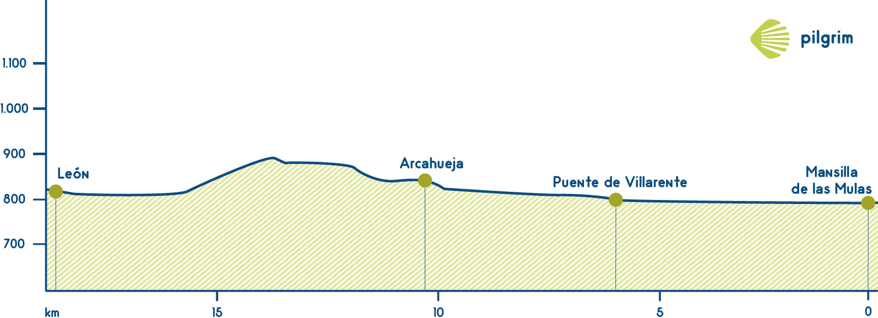
In just under twenty kilometres from Mansilla de las Mulas we reach the majestic capital of the ancient kingdom of León with its imposing cathedral as a symbol of its identity. In between we change the Esla for the Porma and the Torío, approaching León through the suburb of Puente Castro.
Recommendation Pilgrim
For people with disabilities, this section is uncomplicated, except for the occasional slope where caution should be exercised. Cyclists will not encounter any problems in successfully completing this stage, except for some stony sections where the road surface may be somewhat uneven.
Distance and elevation
Stage profile
Route
Itinerary
Km 0 ‧ Mansilla de las Mulas
From the town hall square in Mansilla we take Mesones street and leave the town crossing the river Esla over the stone bridge. We then follow a pedestrian path parallel to the N-601 national road, which is on our right.
Local Information
Police, Medical Care, What to See, Where to Eat…
Km 4,6 ‧ Villamoros de Mansilla
We walk through Villamoros next to the national road N-601, and at the exit we cross the river Porma over a footbridge for pilgrims.
Km 6,0 ‧ Puente Villarente
On leaving Puente Villarente we take a road that comes off to the right of the national road N-601 and which, fortunately, takes us away from the tarmac for a short time, as after three and a half kilometres we have to go under the A-60 motorway via a subway. We are now heading towards Arcahueja.
Km 10,4 ‧ Arcahueja
In Arcahueja we continue straight on along another dirt track; the national road is on our left, about 200 metres further on. After half an hour we come out onto the Corbillos road, at the height of an industrial estate; we turn left onto the N-601, which is a dual carriageway on this stretch. After a little over three kilometres we cross the N-601 over a footbridge. Shortly afterwards we cross another footbridge over the LE-30 ring road.
We enter the district of Puente Castro along Avenida de Madrid; halfway along this avenue we turn left into Calle Victoriano Martínez. We cross the river Torío by a pedestrian footbridge; we can see the Castro Bridge on the right hand side after 80 metres. We follow the long avenue Alcalde Miguel Castañón until we reach the Plaza de Santa Ana; on the right we take Calle Barahona, continue straight on along Calle Puerta Moneda, then turn right into Calle Escurial, continue up Calle Juan de Arfey, cross the Plaza San Martín and, turning right into Calle Plegarias, we reach the Plaza Mayor. Calle Domínguez Berrueta links the Plaza Mayor with the magnificent cathedral.


