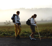
This is the longest stage you will have to walk in the Galician Territory In this stage you will leave Lugo and enter in A Coruña. At this stage, the province of Lugo is abandoned to enter the last of the provinces through which it passes, the province of A Coruña, where it enters through the village of O Coto, bordering both provinces. This is a tough and an irregular stage. We will find short recurrent slopes that will demand our effort.The landscapes will combine sections with good state of preservation as we cross nice villages with non gratifying views from some industrial areas.
Once you get to Arzúa you will meet all pilgrims that come from the Northern Way and you will walk with them to Santiago through the last two stages.
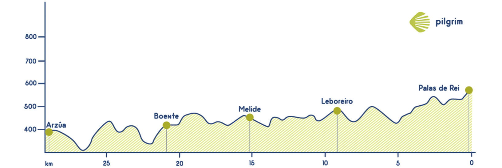
The way leaves Palas de Rei through the national road 547 in the kilometres 35, you will walk a while through a path but then you will return to the national road. Then you should leave the national road and go to the right, following the indications to Carballal, going through Riba. After crossing riba you will return to the national road and you will cross it and you will see a marker that will indicate you the entrance to a path that will lead you to San Xulián do Camiño, located 3 kilometers from Palas de Rei Once you leave this village you will return to a path and a few meters after you will find a crossing, here you should continue straight forward.
After some ups and downs you will enjoy one of the best landscapes in the French Way with lots of trees and green fields; green will be the main color of all you can see here. While crossing the Pimbre river you will feel all the magic that this amazing way hides. You will walk through Ponte Campaña that belongs to Mato, then you will go through Casanova, its houses hide lots of secrets and magic. Here, after walking 5.6 kilometers you will find a public hostel and also a private one that also words as a holiday cottage. After crossing this village you will continue through an asphalted road just for a few meters and then you will turn left, returning to a path that will lead you to Porto de Bois where you should cross the river to continue, this time walking up a little bit to get to Campanilla. Once you get to this wonderful place you have to look back and say goodbye to Lugo, because the next marker will indicate you that O Coto belongs to A Coruña.
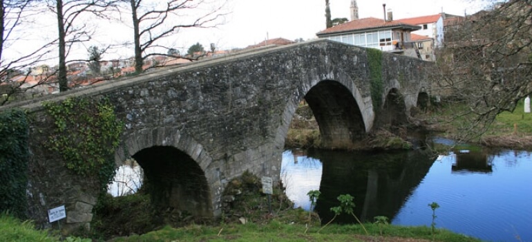
Here, in O Coto you will find a holiday cottage and also a shop where you can buy many things if you need it. After having a break you will continue and you will return to the left through a path that will lead you to Leboreiro one of the most amazing villages in this stage, it has a stone cross and here you can visit the Iglesia de Santa María de Leboreiro that is considered heritage of the Way. You will continue and you will see the marker number 56 that will indicate you that you are now in Discabio, the hardest part in today’s stage. It goes parallel to the national road through a service road that you will leave once you get out of Melide’s industrial park. Then you will get to a recreation area in Furelos where you will cross an affluent of the Ulla river through a medieval bridge with for arches. Then it comes Melide, one of the biggest village in the Galician French Way.
You can leave Melide if you haven’t taste the famous octopus. Galicia offers a great and varied gastronomy that you should taste.
You will continue through the national road 547, you will cross it to enter in the road 4603 to San Martiño turning right and then, a few metres after you should follow the indications to Santa María de Melide a small village that has a Romanesque church with an amazing façade Then you will walk through lovely fields and woods and loads of eucalyptus and other trees to get to A Peroxa that is a village located just before Boente. Here you can find a coffee bar and two private hostels and also the Fuente de la Saleta fountain a place where lots of pilgrims refill their water bottles.
Once you leave Boente you have a little walk up to get to Figueiros and Castañeda where you will start to descend to get to the Arroyo Riberiral stream that is located between Pedrido and Río At this point, the Way becomes steep again for the umpteenth time, where we will cross the road once again and reach a short cobbled stretch of road and head down to what is perhaps the most magical place of our entire stage, Ribadiso, with a hostel ideal for overnight stay. To get to Ribadiso you will have to cross a bridge over the Iso river. Ribadiso is located 3.4 kilometers from Arzúa, you will walk now through the national road. In Arzúa, end of today’s stage, you will find all kind of services that you could need to conclude today’s stage.
What to see
Remember.
We walk by your side! If you have any doubt about this stage or about other stages, please contact us, we will help you. Have a nice Way, Pilgrim!
What to eat
- Typical octopus
- Melindres (pastries mainly made with eggs, anisette, milk, flour and sugar
- Typical cheese from Arzúa
Bear in mind
Some of the parts of this stage are a little bit hard due to the number of walk-ups and descends, especially in Palas de Reis and Casanova. Due to this fact, many times people with reduced mobility need to think about the possibility of going through the LU-663 taking into account that this is a national road and could be dangerous sometimes.
For cyclists the difficulty is normal, we don’t need to highlight anything.
For people that are not too fit we recommend to divide this stage into two parts:
Stage 1: Palas de Rei – Melide (15 kilometres)
Stage 2: Melide – Arzúa (14,5 kilometres)
What to see| Towns | Public Hostel |
Bike rental |
Medical assistance |
Coffe bar |
Teller |
Pharmacy |
Hotel |
Touristic Information |
Guesthouse |
Restaurant |
Supermarket |
Veterinarian |
|
|---|---|---|---|---|---|---|---|---|---|---|---|---|---|
| Palas de Rei | ✔ | ✔ | ✔ | ✔ | ✔ | ✔ | ✔ | ✔ | ✔ | ✔ | ✔ | ✔ | |
| San Xulian do Camiño | ✔ | ✔ | ✔ | ✔ | |||||||||
| Pontecampaña | ✔ | ✔ | ✔ | ||||||||||
| Casanova | ✔ | ✔ | |||||||||||
| O Coto | ✔ | ✔ | ✔ | ✔ | |||||||||
| Leboreiro | ✔ | ||||||||||||
| Furelos | ✔ | ||||||||||||
| Melide | ✔ | ✔ | ✔ | ✔ | ✔ | ✔ | ✔ | ✔ | ✔ | ✔ | ✔ | ✔ | |
| Boente | ✔ | ✔ | ✔ | ✔ | |||||||||
| Castañeda | ✔ | ✔ | ✔ | ✔ | |||||||||
| Ribadiso | ✔ | ✔ | ✔ | ✔ | |||||||||
| Arzua | ✔ | ✔ | ✔ | ✔ | ✔ | ✔ | ✔ | ✔ | ✔ | ✔ | ✔ | ✔ |
