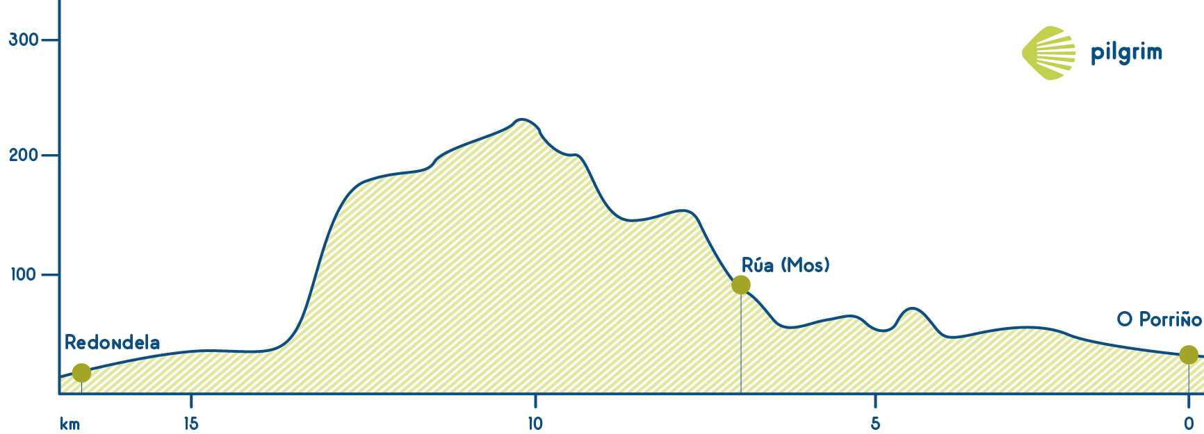
This stage is similar to yesterday’s stage. But we have to highlight that part that goes from Mos’ public hostel to Santiaguiño’s chapel because it very hard, you will have to walk up for three kilometers with 145 meters of uneven. But do not trust this terrain: it may not be as plain as it seems.
The positive part of this hard stage is the wonderful landscape.

You will leave O Porriño through the N-550 to get to a roundabout that separates O Prriño and Mos where you will find many shops and services. This first part of the stage is a little bit difficult, so you will have to be careful with the road. Then you will go through Coto Filgueiras towards Ameiro Longo. You will cross this village just to get to the N-550. This road will lead you to the main crossing in Mos where you will have to turn away to get to Vegadal and then you will return to the original way.
Once you get to Mos you can stop to rest and visit some monuments such as its church and its country house.
Now it comes the hardest part of today’s stage, the walking up to Santiaguiño. While walking up you will cross some different villages such as Cabaleiros, A Pereira and Inxertado and also you will combine asphalted roads and path until getting to Santiaguiño de Antas the highest point of today’s stage. Santiaguiño is a small village that apart from the wonderful landscape just has a chapel. Every 25th of July there is a big party in this chapel due to apostle’s fest. It has a St. James’ image inside and also many symbols related with him inside and outside.
Once you leave Santiaguiño you will find a Milladoiro (it is a rock that used to indicate the roads’ distance) that will indicate you how many kilometres are to get to Santiago. After this point you will be combining all the time asphalted road with paths and crossing villages such as Casal do Monte and Padrón to get O Souto, and then you will return to the N-550 and start to descend.
A little bit after you will get to Redondela and you will start to descend, there are no more walking ups for today. While descending you will enjoy Redondela’s landscape, this part of the way is well indicated because there are lots of small villages very close ones from the others. Just follow the yellow arrows.
You will cross O Muro to get to Redondela, the end of today’s stage. There are lots of pilgrims that decide continue to Pontevedra, but is up to you.
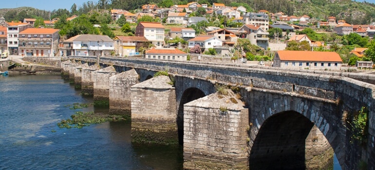
Once you get to Redondela you will see San Simón Island and also two huge train bridges. The town council lend bikes, you can take one to visit all the village. In 2015 the town council put a bench in the highest part of the village to see all the estuary that offers a wonderful and lovely views.
What to see
Remember.
We walk by your side! If you have any doubt about this stage or about other stages, please contact us, we will help you. Have a nice Way, pilgrim! Have a nice Way, pilgrim!
What to eat
The most famous product in Redondela is choco, a typical mollusk from the estuary It is like a squid. You can find this mollusk in other many places but here is very abundant. That is the reason for its quality and for being so typical in this village.
Bear in mind
You will have to be very careful at this stage because you will have to walk through the N-550 but also cross it many times. We recommend you wear special clothes such as a reflective vest so cars will see you better and sooner. This recommendation is for all kind of pilgrims not just for the ones that go walking.
Cyclists you be very careful while descending from O Santiaguiño because is a complicated path.
What to see| Towns | Public Hostel |
Bike rental |
Medical assistance |
Coffe bar |
Teller |
Pharmacy |
Hotel |
Touristic Information |
Guesthouse |
Restaurant |
Supermarket |
Veterinarian |
|---|---|---|---|---|---|---|---|---|---|---|---|---|
| O Porriño | ✔ | ✔ | ✔ | ✔ | ✔ | ✔ | ✔ | ✔ | ✔ | ✔ | ✔ | ✔ |
| Mos | ✔ | ✔ | ✔ | ✔ | ✔ | ✔ | ✔ | ✔ | ✔ | |||
| Redondela | ✔ | ✔ | ✔ | ✔ | ✔ | ✔ | ✔ | ✔ | ✔ | ✔ | ✔ | ✔ |
Towns


